Overview

This case study details the experience of NorthGroup Consulting in leveraging the Trimble SX12 scanning total station to overcome significant challenges in large-scale mobile laser scanning (MLS) projects within rail corridors. It highlights how this innovative solution drove new heights in efficiency, data quality, and safety standards, particularly when NorthGroup Consulting was faced with stringent accuracy requirements and difficult site access.

About NorthGroup Consulting

NorthGroup Consulting, based in Stafford, Qld, and formerly North Surveys (est. 1984), has evolved into one of Queensland’s largest surveying firms. The company thrives on complex projects, offering innovative Surveying, Mapping, and Data Management solutions; its core mission is to deliver high-accuracy data efficiently while adhering to the strictest safety protocols. A key strength lies in its leadership in 3D Laser Scanning technology, where NorthGroup Consulting constantly develops advanced methodologies. This commitment to practical innovation in demanding survey environments, as demonstrated by industry recognition, underpins its success.

The Challenge

Surveying Expansive and Restricted Rail Corridors

The geospatial industry continually grapples with managing mobile laser scanner data efficiently under tight project timelines and budget constraints. This challenge, rooted in the complexities of traditional data collection and processing, directly impacts project delivery, data quality, and safety.

NorthGroup Consulting’s team was tasked with two significant rail corridor projects:

Initial 20 km Project: An MLS survey of approximately 20 km of rail corridor for rail duplication design, plus surrounding roads. Key requirements included:

  • ±10 mm horizontal and vertical accuracy.
  • Control/QA points every 250 m.
  • Minimal disruption to road/rail traffic and no access to the rail danger zone.
  • Due to access and safety, NorthGroup Consulting initially planned to use GCPs to control the road MLS, which would then control the rail MLS. Terrestrial laser scanning (TLS) was earmarked for areas with insufficient cloud overlap, performed outside the danger zone.

Sudden 100 km Expansion: On the first day of the initial capture, the client requested an additional 100 km of rail MLS, with approximately 70 km requiring post-control. Specifications remained identical (±10 mm accuracy, control/QA every 250m, no danger zone access for control establishment). Crucially, no GCPs had been installed at the time of this extended MLS capture. Access to the rail corridor itself was permissible in this section as it wasn’t near roads for external survey, but control still needed to be established safely and efficiently.

The primary challenge for the 70 km section was finding an alternative methodology to post-control the MLS data without pre-installed GCPs. Traditional options presented significant drawbacks for NorthGroup Consulting:

  • Total Station Survey of Features:

    Requires precise definition of each point for MLS cloud processing, which is labour-intensive.

  • Traditional Terrestrial Laser Scanning (e.g., Leica RTC360):

    • Time-consuming: Only ~7 sites per day were achievable on the initial 20 km project.
    • Resource-intensive: Required a two-man crew.
    • Inefficient data: Full dome scans often capture mostly irrelevant data.
    • Office bottlenecks: Required significant office registration time.
    • For the ~280 sites needed for the 70 km section, this would mean approximately two months of fieldwork plus considerable registration time, far exceeding client timelines.
  • Long-Range Scanners (e.g., Riegl VZ600i):

    While offering GNSS RTK and selectable scan areas, these still required office registration and didn’t sufficiently reduce data collection time.

The Solution

Adopting the Trimble SX12

Based on previous experiences and a renewed interest sparked at Trimble Dimensions, NorthGroup Consulting identified the Trimble SX12 as a potential game-changer. After testing a unit provided by UPG, its capabilities perfectly aligned with NorthGroup Consulting’s needs for the 70 km post-control challenge.

The methodology for the 70km section involved:
  1. Utilising previously installed, coordinated marks (established via GNSS static for horizontal and differential levelling for vertical, approximately every 1 km) as a base control network.
  2. Setting up the Trimble SX12 via resection over these known marks.
  3. Performing targeted, feature-rich scans of relevant features for MLS point cloud control.

This approach provided millions of potential control points rather than a select few, offering robust data for validation.

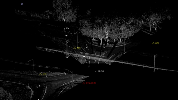
Sample SX12 point-cloud with three survey marks

Key Advantages of the Trimble SX12

The Trimble SX12 offered a suite of benefits that directly addressed the project’s pain points:

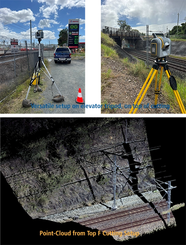
  • Versatile Setup: Ability to set up like a standard total station over a known point or via resection.
  • Targeted Scanning: Capability to focus on specific areas and features, avoiding irrelevant data capture (unlike full 360° scans where 90% can be unnecessary).
  • Selectable Scan Resolutions: Optimising data density for the task.
  • Ease of Use: Simplified operation, removing the complexity of traditional scanning.
  • Reduced Personnel: No need for specially trained scanning personnel or additional staff for registration.
  • Manageable Data Volumes: Smaller, focused point clouds improved processing efficiency.
  • Increased Field Productivity: Significantly more sites covered per day.
  • No Office-Based Registration: Data was field-registered, drastically reducing office processing time.
RPS Scanning point clouds

Why the Trimble SX12 and the role of TBC?

Traditional terrestrial laser scanning was deemed unviable due to prohibitive time constraints for both fieldwork and registration. The SX12 was chosen because it uniquely combined the precision of a total station with the rich data capture of a scanner, while eliminating the bottlenecks of traditional scanning workflows. Its ability to perform targeted scans from resected positions using existing control was the critical factor for efficiently post-controlling the 70 km of MLS data.

Trimble Business Center (TBC) played a critical role in the data processing workflow for this project. Control marks for the SX12 were established using GNSS RTK and digital levelling, and TBC was used to reduce and process both datasets. Following this, TBC was also used to reduce and register the SX12 scan data, allowing for seamless integration of field measurements and scan outputs within a single, consistent coordinate framework. Its use streamlined the workflow and maintained data integrity from field to final deliverable.

Project Example: Post-Controlling 70 km of Rail MLS & Bridge Underside Scanning

  • 70 km Rail Corridor Post-Control:

    Using the SX12, a single surveyor from NorthGroup Consulting completed approximately 30 sites per day. The entire 70 km survey, requiring control/QA every 250 m (roughly 280 sites), was finished in just two weeks. Office work (data import, checking, export) took only one week due to the elimination of the registration process. The manageable, feature-focused point clouds were ideal for MLS processing and allowed the NorthGroup Consulting team to query the MLS point cloud up to 100m, identifying and correcting heading and verticality issues.

  • Bridge Underside Scanning:

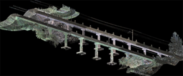
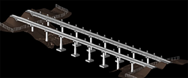
    An additional task involved scanning the undersides of rail bridges to create IFC models with 2 mm accuracy for design and construction monitoring. Initially planned for a traditional TLS, NorthGroup Consulting opted for the SX12 due to its earlier success. A control network was established around the bridge, the SX12 was coordinated using resection, and scans were performed from multiple positions to avoid shadowing. The resulting point cloud was used to create the IFC model. The SX12, combined with Trimble Access, allowed for on-the-spot result production and ongoing monitoring.

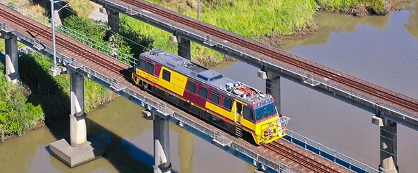
MSL Scanning in Progress

MLS Scanning in progress

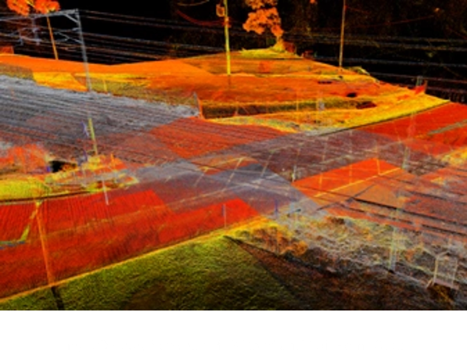
Combined MLS (top of bridge) and SX12 (underside of bridge)

Combined MLS (top of bridge) and SX12 (underside of bridge)

IFC Model of the bridge

IFC Model of the bridge

Benefits realised and issues overcome

Benefits:

  • Drastic Time Savings:

    Fieldwork for 280 sites completed in 2 weeks by one surveyor (vs. an estimated 2 months for two surveyors with traditional TLS).

  • Massive Efficiency Gains:

    Office processing reduced from potentially weeks (for registration) to just one week (for import/check/export).

  • Improved Data Quality & Validation:

    Feature-rich scans provided superior validation of the MLS point cloud.

  • Enhanced Safety:

    Minimised time in the rail corridor and allowed setups outside danger zones using existing control.

  • Cost Savings:

    Reduced labour and faster project turnaround.

Issues Overcome:

  • Initial Scepticism:

    NorthGroup Consulting overcame internal and external pushback against SX10/SX12 systems by demonstrating their capabilities through testing.

  • Initial Scepticism:

    NorthGroup Consulting overcame internal and external pushback against SX10/SX12 systems by demonstrating their capabilities through testing.

  • Post-Control without Pre-Installed GCPs:

    The firm successfully addressed the critical challenge of controlling the 70 km MLS capture using the SX12 and NorthGroup Consulting’s existing coordinated marks.

Lessons Learned

  • Embrace Innovation:

    Testing and adopting new technologies like the SX12 can fundamentally transform traditional workflows.

  • Challenge Assumptions:

    The general opinion that “if scanning was needed, a traditional laser scanner should be used” was proven not universally true for all applications.

  • Targeted Data is Key:

    Focusing data capture on relevant features significantly improves efficiency in both field and office.

  • Integrated Solutions:

    The combination of total station functionality with scanning capability in one instrument (SX12) offers immense flexibility and power.

Conclusion

The adoption of the Trimble SX12 was a transformative step in NorthGroup Consulting’s approach to MLS surveying in challenging rail corridor environments. By harnessing its advanced capabilities, the company successfully navigated the complexities of working inside the rail corridor, significantly reducing delivery times, enhancing data quality, and improving project outcomes. The SX12 not only streamlined data collection and processing but also ensured adherence to stringent safety standards, ultimately revolutionising NorthGroup Consulting’s methodology for large-scale MLS projects.