FIELD SOFTWARE

MAXIMISE YOUR WORKFLOWS

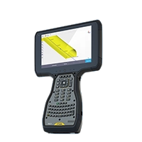
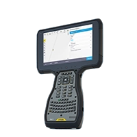
Field Software. Tailored for specific workflows ranging from surveying, 3D laser scanning, and GIS asset data collection to specialised applications.

Ensures consistent and standardised outcomes, leading to expedited deliverables. Maintain connectivity with the office, enhancing productivity to meet the demands of your field work efficiently.

Field software

Trimble field software solutions for surveying, mapping, and GIS applications provide a complete approach to managing fieldwork. Trimble field solutions enable consistent, standardised data collection, achieve faster time-to-deliverable, keep you connected to the office, and improve your competitive edge with increased productivity and easy access to new, specialised applications.

TRIMBLE ACCESS

All day. Everyday. Designed to support the way surveyors work.

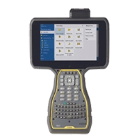
Trimble Access is a leading field software used by professional surveyors around the world, with functionality that supports efficiency, accuracy and ease of use with simplified workflows.

Trimble AccessPlus

Supporting everyday workflows with features that deliver great flexibility and efficiency as you work.

Field Software - Trimble AccessPlus

Trimble Access General Survey

Complete surveying solution for digital workflows.

Trimble Access General Survey

Trimble Access Roads

Powerful road stakeout software.

Trimble Access Roads

Trimble Access Rail

Powerful suite of railway track-specific software modules.

Trimble Access Rail

Trimble Access Powerline

Streamlined workflow to measure and estimate the sag.

Trimble Access Powerline

Trimble Access Pipeline

Track and record pipeline data in the field.

Trimble Access Pipeline

Trimble Access Monitoring

Streamlined monitoring data capture.

Trimble Access Monitoring

Trimble Access Tunnels

Survey tunnel projects efficiently.

Trimble Access Tunnels

Trimble Access Mines

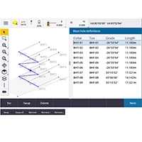
Powerful tools to survey and report on underground mine operations.

Trimble Access Mines

Trimble Access SDK

Third-party development framework for Trimble Access.

Trimble Access SDK

FIELD SOFTWARE GIS WORKFLOWS

Trimble Penmap

Simple survey and GIS data collection.

Field Software - Trimble Penmap

Trimble SiteVision

Outdoor and indoor augmented reality (AR) system.

Trimble SiteVision

Trimble TerraFlex

Cloud-based solution for streamlined field data capture.

Trimble TerraFlex

Trimble TerraSync

Field Software for Trimble TerraSync

FREQUENTLY ASKED QUESTIONS

Trimble Access stands as our premier field software, trusted by professional surveyors globally. Tailored by surveyors for surveyors, it accommodates both fundamental and advanced workflows. For specialised tasks, explore dedicated field software options like Trimble TerraFlex for GIS asset mapping and inspection, and Trimble Perspective for operating Trimble 3D scanners.

Trimble software supports all current Trimble R-series GNSS receivers. For a comprehensive list of which Trimble GNSS receivers are supported by each software.

The Help Portal is a useful resource with help and release notes available for all Trimble Geospatial software.

You can download the latest version of Trimble Access through the Trimble Access Installation Manager for Windows or Android devices. For other software packages, visit the individual product page for instructions on how to download the latest version.

Subscription licenses are available for many software apps, including Trimble Access, Trimble TerraFlex, Trimble SiteVision and Trimble Penmap for Android.

Reach out to our experts. We understand your local industry needs and will recommend the Trimble products best suited to your applications. They can also provide product demonstrations, expert training, and ongoing maintenance and support.