Trimble SiteVision

AUGMENTED REALITY

Instant visualisation for immediate insights.

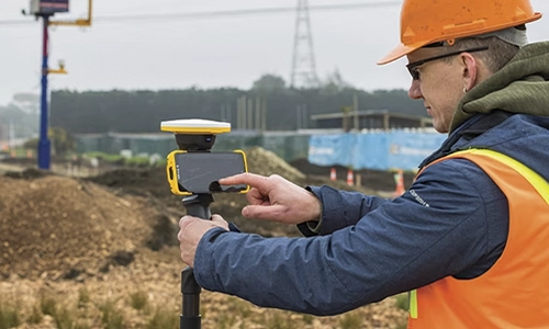
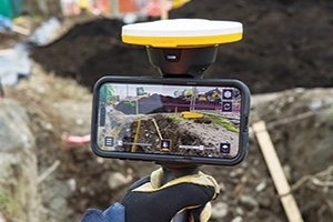
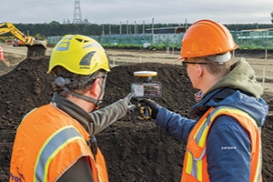
Trimble® SiteVision® is a real-time, in-field visualisation software that helps you collaborate on project progress and identify design changes or conflicts. Select your hardware configuration to capture images, GNSS points, EDM points, or LiDAR scans.

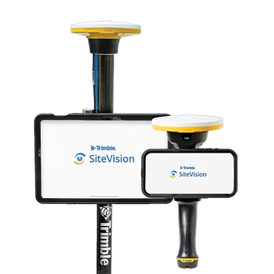
Trimble SiteVision on tablet and mobile

VIDEO

A picture is worth a thousand words

Unlock the potential of spatial data visualisation with Trimble SiteVision.

Benefits and performance

SiteVision enables your entire project team to visualize data in new ways, enhancing collaboration and helping to identify design changes early. This leads to time savings and reduced project costs.

Trimble SiteVision on a mobile with person onsite

Check Your Design in the Real World

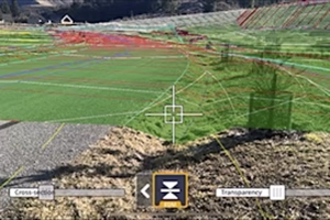
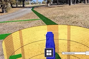
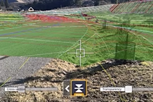
Place digital designs accurately in the real world and use AR to confidently visualise your plans. From underground services to conceptual designs, SiteVision makes analysis simpler and more effective.

Real-Time Data, Real-Time Collaboration

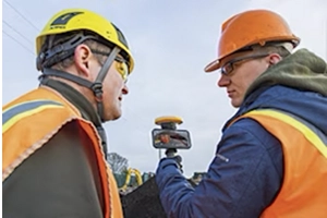
Easily share and collaborate in real time with clear visualizations, enabling stakeholders to make informed decisions quickly.

TIMBLE SITEVISION IS ALREADY AT WORK IN YOUR INDUSTRY

Utilities

  • Replace paint marks and 2D plans with precise visualisations
  • Verify and confirm database integrity, improve safety, and enhance awareness on the job site
  • Turn existing GIS data into easy to understand 3D models complete with attributes for public and contractor engagement
  • Check utility location offsets from property boundaries and occupation, or measure the distance between pipes, pylons, or valves within your model
  • Supports 2D and 3D data from Esri databases, digital elevation models, .DWG, .SKP, and .IFC data formats

Local Government

  • Promotes citizen engagement and collaboration between government offices, inspectors and public stakeholders which ultimately help save you time and money
  • Delivers real-time visualisations of information such as locating emergency services following a disaster, planning a public works project, or protecting and preserving a cultural or heritage site
  • Displays complex goverment database information as easily understood visualisations so that issues and discrepancies can be quickly identifid and reported leading to efficient and confident decisions

Cadastral Survey

  • Visualise parcel boundaries in real-time in the context of the field environment
  • Accurately locate busied monumentation
  • Monitor site progress through easy to understand visualisations
  • Turn existing geospatial data into ease-to-understand 3D models complete with attributes for public and contractor engagement

Key specifications

The Trimble R580 is a reliable, integrated receiver designed for everyday survey-grade workflows.

  • 1 cm H/2 cm V Real-time kinematic precision

  • Android or iOS Connect a phone or tablet

  • Lightweight Pole or handle mount

Features and capabilities

SiteVision-in-3D

VISUALISE IN 3D

Catch problems early

Quickly identify discrepancies between the design and existing conditions, both above and below ground. Avoid costly rework by detecting conflicts early.

SiteVision-Collaboration with two men on mobile

COLLABORATE

Improve communication

With revision controls built into Trimble Connect, a cloud-based collaboration platform, you’ll never have to worry about using outdated designs.

geo-hps2-stockpile-site

MEASURE

Quickly collect field data

Measure positions, volumes, areas, slopes, cut/fill, and more with the Trimble Catalyst™ DA2 GNSS system, LiDAR-enabled devices, and augmented reality.

geo-hps2 up close

REPORT

Summarise your data

Capture pictures, create tasks, report statuses, request clarifications, and assign them to team members or share with clients— all in real time.

Works with

Trimble DA2 Studio Shot

GNSS SYSTEMS

Trimble DA2

Designed for the Trimble Catalyst positioning service.

Trimble HPS2 Studio Shot

GNSS SYSTEMS

Trimble HPS2

A handheld solution to use your phone with GNSS and an EDM.

Resources and knowledge

Trimble GNSS Blog Link

BLOG

Go beyond the data

Showcasing workflows, projects, and the people driving their success.

Trimble_scanner

VIDEOS

Watch what Trimble can do

Informative solution summaries, Q&A sessions, webinars, tutorials, and additional resources.

Person watching Trimble videos

WEBINARS

Join live or watch later

Register for upcoming webinars and watch on-demand recordings.

Trimble SiteVision