DJI MATRICE 4E

COMPACT & PORTABLE DRONE

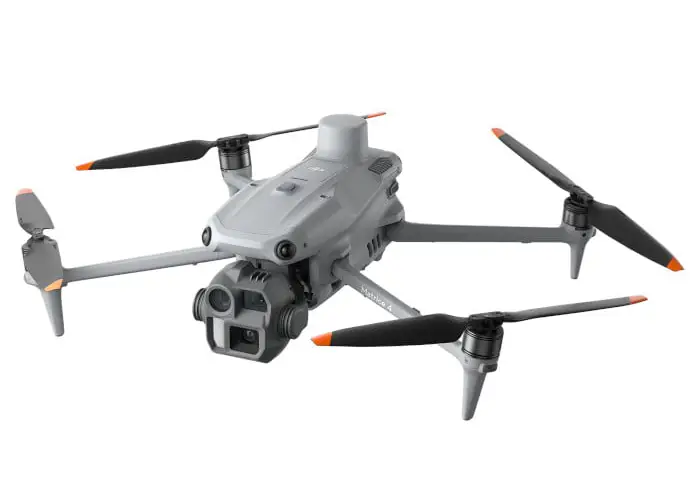
DJI Matrice 4E is a compact and intelligent multi-sensor flagship drone series for enterprise industries equipped with advanced features such as smart detection and measurement with laser range finder.

Flight operations are now safer and more reliable with significantly enhanced sensing capabilities.

DJI Matrice 4E

DJI DRONE FOR SURVEYING

Organisations choosing the Matrice 4E for their drone solutions.

ENGINEERED FOR EXCELLENCE, DESIGNED FOR VERSATILITY

The Matrice 4E is designed for geospatial applications such as surveying and mapping, construction, and mining.

DJI MATRICE 4E FEATURES

Excels in Low-Light

Excels in Low-Light

Built for Challenging Conditions

Challenging Conditions

Full-Color Vision Assist

Full-Color Vision Assist

49 minutes of flight time

49 minutes of flight time

Real-Time Terrain Follow

Terrain Follow

DJI Care Enterprise

Flexible mission planning

POWERFUL PAYLOADS

The DJI Matrice 4E supports a maximum payload of 200 grams. This relatively light payload is optimised for compact missions, particularly in photogrammetry, inspection, and environmental monitoring.

Zenmuse P1

Zenmuse P1

Zenmuse P1 integrates a full-frame sensor with interchangeable fixed-focus lenses on a 3-axis stabilised gimbal. Designed for photogrammetry flight missions, it takes efficiency and accuracy to a whole new level.

Zenmuse L2

Zenmuse L2

Zenmuse L2 integrates frame LiDAR, a self-developed high-accuracy IMU system, and a 4/3 CMOS RGB mapping camera, providing DJI flight platforms with more precise, efficient, and reliable geospatial data acquisition.

Zenmuse H30 Series

Zenmuse H30 Series

The Zenmuse H30 Series uses a combination of five sensors—wide-angle, zoom, thermal, laser rangefinder, and NIR auxiliary light—to achieve superior day and night vision through advanced intelligent algorithms. 

Zenmuse S1

Zenmuse S1

DJI’s first spotlight for multi-payload drones, using LEP technology to provide powerful illumination for nighttime operations like public safety, emergency rescue, & inspections. It features high brightness, a long illumination distance, and multiple lighting modes.

Zenmuse V1

Zenmuse V1

The Zenmuse V1 is an innovative loudspeaker for drone payloads, featuring high volume, long-distance broadcasting, and multiple operational modes, making it suitable for public safety and emergency rescue operations.

Manifold 3

Manifold 3

A compact and powerful processing unit that provides 100 TOPS of compute power for the Matrice 400 drone. Its lightweight design, weighing around 120g, improves drone efficiency for various tasks by offering robust processing capabilities. 

ENHANCED INTELLIGENCE AND EFFICIENCY

Laser Range Finder, Precise Measurement

The laser range finder delivers precise real-time measurements.

With intuitive tools like pinpointing, line drawing, and area calculation, it supports tasks such as marking inspection targets or estimating wildfire coverage.

Information can be easily shared via DJI Pilot QR code or FlightHub 2, streamlining collaboration and boosting workflow efficiency.

Smarter Operations

The integrated model identifies vehicles, vessels, and individuals during both search and rescue missions and routine flights.

It also allows seamless switching to alternative models, broadening its range of applications. Additionally, it supports high-resolution grid imaging and offers advanced tracking capabilities.

Observation Range Recording

DJI Pilot 2 can highlight both the center of the camera frame and the observed ground area.

It also maps the surveyed region, making it especially valuable for patrols and rescue missions in mountainous terrain where clear landmarks are lacking.

OPEN DEVELOPER ECOSYSTEM

Intelligent Algorithm Developer

Provides the necessary model training tools and third-party developer certification process to access onboard computing capability, helping to expand new application fields for drones.

PSDK

The newly upgraded E-Port V2 supports USB 3.0 high-speed payload communication and delivers up to 120 watts of power per port. The E4 port of the E-Port V2 can be expanded into four payload ports via the E-Port Hub expansion plate, unlocking broader application scenarios and greater potential for the Matrice 400.

MSDK

Mobile SDK 5 simplifies the development of apps to control the Matrice 400. It comes with fully open-source, production-level code samples with core modules adapted from DJI Pilot 2, guaranteeing high reliability.

Cloud API

With DJI Pilot 2’s built-in Cloud API (MQTT-based protocol), you can directly connect the Matrice 400 to third-party cloud platforms. Access the drone’s hardware, video live-stream, and photo data without having to develop an app.

Open Data Access

Developers can leverage payload, LiDAR, mmWave radar, and vision sensor data interfaces to build innovative applications and expand the DJI ecosystem.

APPLICATIONS

Geospatial Surveying & Mapping

GEOSPATIAL

Geospatial drone solutions deliver precise digital outputs that empower managers, surveyors, and engineers to optimize operations across the entire project lifecycle.

By capturing aerial data efficiently, drones support faster decision-making, reduce costs, enhance safety, and improve overall productivity.

Land Survey

Rapidly produce accurate 2D and 3D models. Cover larger areas with fewer resources, improve safety, and lower operational expenses.

Cadastral Survey

Accelerate land administration and cadastral workflows using high-precision drone systems to generate detailed digital models quickly.

Urban Planning

Generate reliable 2D and 3D maps that integrate seamlessly with local GIS platforms, helping teams visualise and plan with confidence.

LIDAR

  • Topo survey through vegetation
  • Survey during nightworks
  • Powerline survey
Lidar

FREQUENTLY ASKED QUESTIONS

The Matrice 4E is designed for high-precision mapping, surveying, and inspection tasks. It’s widely used in industries such as construction, agriculture, energy, and emergency response.

It includes a 4/3-inch CMOS 20MP wide-angle camera with a mechanical shutter, plus two telephoto modules (48MP each) for medium and long-range imaging.

Yes, the wide-angle camera supports mapping without GCPs, making it ideal for rapid deployment and efficient workflows.

No, it is not waterproof. Users should avoid flying in rain or wet conditions to prevent damage. If exposed to moisture, ensure the drone is fully dry before reuse.

Connect the DJI RC Plus 2 Enterprise Edition to Wi-Fi or a hotspot, then follow the on-screen instructions in the DJI Pilot 2 app to activate both the controller and the aircraft.

The Matrice 4E can fly for up to 45 minutes under standard conditions, allowing for extended missions with fewer battery swaps.

No, the RTK module is fixed and not designed to be removed or swapped.

You can connect to Network RTK via Wi-Fi on the remote controller. The RTK service is bound to the controller, not the aircraft.

It supports a range of enterprise accessories including enhanced sensor mounts, extended-range antennas, and payload modules for zoom, thermal, and multispectral imaging.

PAIR YOUR DRONE WITH POWERFUL SOFTWARE

Maximise the potential of your DJI drone with our industry-leading photogrammetry and mapping software solutions. Process your data with confidence and generate accurate deliverables.

ADDITIONAL DRONE MODELS

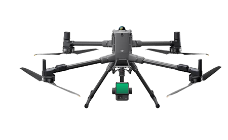
DJI MATRICE 350 WITH P1 CAMERA OR L2 LIDAR
FLAGSHIP SURVEY DRONE

Integrate Lidar and office processing.  Topo mapping through vegetation, powerlines, applications beyond photogrammetry.

DJI DOCK 2
DRONE IN A BOX
 

Drone in a box
DRONE HARDWARE & SOFTWARE

Complete Drone in a box solution including hardware and software for multiple applications. A drone solution at your fingertips.