A Legacy of Innovation
Trimble Geospatial Milestones.
From electronic distance measurement to centimetre-accurate positioning, 3D scanning and advanced GNSS — discover some of the innovations that have helped shape the geospatial industry.

Trimble Geospatial Milestones.
From electronic distance measurement to centimetre-accurate positioning, 3D scanning and advanced GNSS — discover some of the innovations that have helped shape the geospatial industry.
Surveying has changed dramatically over the past 80 years.
Technologies that once seemed revolutionary have become everyday tools for surveyors, while new innovations continue to push the boundaries of what can be measured, captured and achieved in the field.
Trimble’s history is closely connected to that evolution. Through Trimble and the companies that have become part of the Trimble family, a long series of innovations has helped transform surveying from predominantly manual measurement into the highly connected, digital workflows used today.
Here’s a look at some of the key milestones along that journey.
From the first electronic distance measurements to today’s connected GNSS and reality capture solutions, each milestone has helped move the industry forward.
The Beginning of Electronic Distance Measurement
Company: AGA / Geodimeter, Sweden
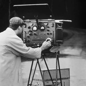
Electronic distance measurement was one of the major breakthroughs in modern surveying.
The Geodimeter Model 0 and Model 1 introduced electronic distance measurement technology, laying the groundwork for a new generation of surveying instruments and helping move the industry beyond traditional optical measurement.
The Automatic Level
Company: Carl Zeiss
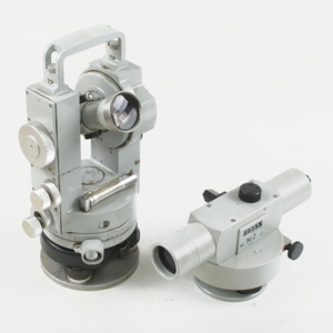
The introduction of the Zeiss Ni 2 automatic level brought greater efficiency and consistency to optical levelling.
Using a suspended optical prism as a mechanical compensator, the instrument automatically levelled the line of sight, helping speed up levelling operations.
The First Total Station
Company: AGA Geodimeter / Carl Zeiss
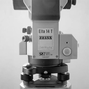
By bringing electronic distance measurement and electronic angle measurement together in a single instrument, total stations marked a major step forward for modern surveying.
GPS Comes to Commercial Surveying
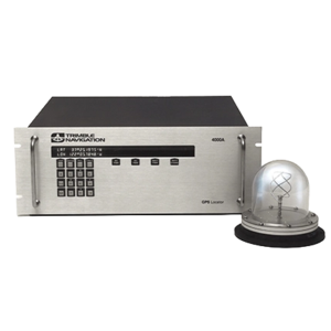
When Charlie Trimble founded Trimble in 1978, GPS was still largely an experimental military technology.
Just six years later, Trimble introduced the Model 4000 series — one of the first commercially viable GPS positioning products.
This helped demonstrate the potential of satellite positioning for surveying, offshore exploration, marine navigation and other commercial applications, opening the door to an entirely new way of measuring position.
Robotic Total Stations
Automation was taking another step forward with the introduction of robotic total station technology. The Geodimeter System 4000 helped establish the foundations for robotic surveying workflows, allowing instruments to be operated remotely and reducing the need for traditional two-person instrument setups.
Commercial 3D Laser Scanning
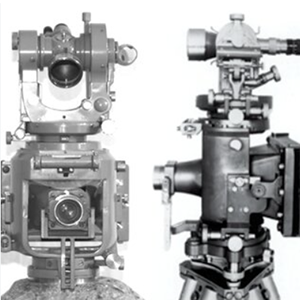
3D laser scanning brought a new dimension to reality capture. Developed by MENSI, the SOISIC tubular scanner helped establish the foundations of the commercial 3D scanning and LiDAR industry, allowing complex structures to be captured as detailed three-dimensional point clouds.
MENSI was acquired by Trimble in 2003, bringing this technology into the broader Trimble portfolio.
Real-Time Kinematic Positioning
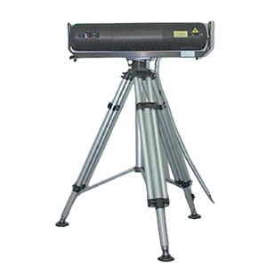
Real-Time Kinematic (RTK) technology changed expectations around GPS positioning. Instead of collecting data in the field and waiting for lengthy office-based post-processing, RTK enabled surveyors to obtain centimetre-level positioning information in real time.
For field crews, this meant greater productivity and the ability to make accurate positioning decisions while still on site.
The Connected Field Controller
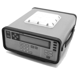
As surveying technology became increasingly digital, the field controller became an essential part of the workflow. The Trimble TSC1 introduced a handheld field controller with a multitasking operating system, helping surveyors manage more of their field data and instrument workflows from a single device.
Centimetre-Accurate Global Corrections
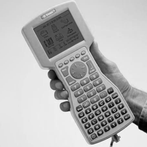
GNSS positioning took another significant step forward with Trimble CenterPoint RTX. The service provided real-time, centimetre-level global Precise Point Positioning (PPP) corrections, reducing reliance on traditional local base station infrastructure and expanding the possibilities for high-accuracy positioning across a wide range of locations.
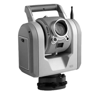
Scanning Meets the Total Station
The Trimble SX10 brought together three powerful capabilities in a single instrument: total station measurement, 3D scanning and imaging.
This combination gave surveyors the ability to move between conventional surveying and high-density reality capture without changing instruments, helping streamline workflows and capture far more information from the field.
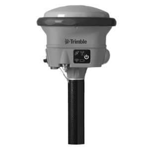
GNSS and Solar Activity
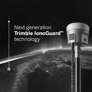
GNSS signals can be affected by changes in the Earth’s ionosphere, including disturbances associated with solar activity. Trimble continued to advance GNSS technology to help mitigate these effects, supporting reliable positioning performance even as conditions in the space environment change.
From measuring distances electronically to capturing millions of points in 3D and delivering centimetre-level positioning in real time, the evolution of geospatial technology has transformed the way professionals work.
What began with individual breakthroughs in measurement and positioning has developed into connected workflows where field instruments, software, cloud platforms and data work together.
And the innovation continues.
At UPG, we’re proud to be part of the Trimble geospatial community, supporting surveyors and spatial professionals across Australia with the technology, expertise, training and support they need to get the most from their workflows.
AUTHORISED PARTNERS

COMPANY
LEGAL
ADDITIONAL
HELP
