ComNav LS600 Laser Scanner

Unleash Unprecedented Power, Precision, and Portability in 3D Scanning

In a world where data accuracy and operational efficiency are paramount, the ability to rapidly capture complex environments is a critical advantage. The CommNav LS600 SLAM System is engineered to meet this challenge head-on. Designed for professionals who need to scan areas that are difficult or impossible to access with traditional methods, the LS600 is the perfect, versatile addition to any scanning fleet, empowering you to tackle every project with confidence.

Scan any environment with the speed and flexibility of the ComNav LS600:

  • Accelerate Your Data Collection

    Select from 16 or 32-line LiDAR configurations to capture 640,000 points/second at a range of up to 300m, dramatically speeding up fieldwork in any environment.

  • Maintain Accuracy Without GPS

    When working indoors, underground, or anywhere GNSS is unavailable, the LS600 maintains absolute accuracy by seamlessly tying into known on-site control points, ensuring a continuous and reliable workflow

  • Adapt to Any Project, Anywhere

    The LS600 is engineered for true all-terrain performance. Deployed via a backpack or pole mount, it excels in any environment, making it the ideal go-anywhere solution for a diverse range of applications from urban planning to mining surveys

  • Scan with Confidence in Any Condition

    The system’s multi-sensor fusion combines LiDAR, IMU, GNSS, and cameras to ensure robust and reliable performance, even in challenging low-light, GNSS-denied, or tight-access environments

  • Bring Your Scans to Life with Vivid Color

    The system’s dual 16MP cameras and visual SLAM technology work in tandem to generate stunning, photorealistic point clouds, enriching your data with true-to-life colour and enhanced scene realism

  • Create Polished Deliverables with Ease

    The RealEditor software provides a seamless post-processing workflow. It uses automated tools for stitching, denoising, and user removal to transform raw field data into high-quality, final results without the typical complexity or headaches

  • Achieve Centimetre-Level Accuracy

    The built-in RTK module is powered by an advanced multi-constellation GNSS engine, delivering robust real-time corrections for absolute accuracy, even in complex signal environments

  • Simplify Your On-Site Workflow

    The LS600 streamlines fieldwork with intuitive, flexible controls. Start scanning with a single onboard button for quick operation, or use the companion Android app for full remote access, making data collection remarkably straightforward and efficient

Compact, Capable, Quick – Your Go-To Handheld for Reliable Results

The ComNav LS600 is a next-generation handheld 3D laser scanner that redefines what’s possible in mobile mapping. At its core is a seamless fusion of advanced technologies: robust SLAM algorithms for continuous tracking, a built-in RTK module for centimetre-level georeferenced accuracy, and dual wide-angle cameras that bring your point clouds to life with vivid, realistic colour. This powerful multi-sensor integration of LiDAR, IMU, and camera ensures exceptional performance and reliability in any environment, from complex indoor spaces to expansive outdoor sites.

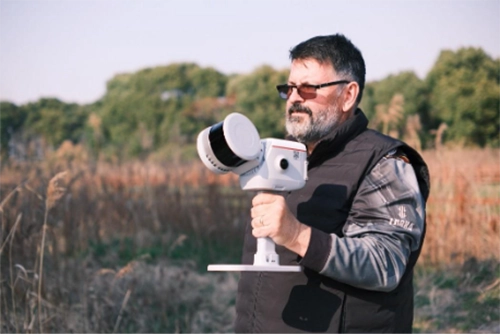
Man holding ComNav LS600 Laser Scanner

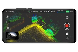
ScanMaster: Real-Time Field Control

LS600 ScanMaster real-time field control

In the field, the ScanMaster Android app puts full control in your hands. Use your mobile device for real-time previews, remote operation, control point identification, and RTK configuration while you scan.

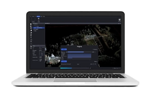
RealEditor: Powerful Office Post-Processing

LS600 RealEditor powerful office post-processing

Back in the office, RealEditor software delivers powerful post-processing. Its simple workflow handles SLAM optimisation and transformations, preparing high-quality point clouds for packages like Trimble Business Center.

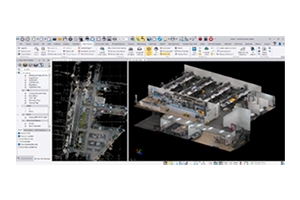
Your Bridge to Final Deliverables

LS600 refine field data into pointcloud

Use RealEditor to refine field data into a clean point cloud, ready for producing final deliverables in packages like Trimble Business Center.

Data Scans

With the LS600, you can achieve high-speed scanning without sacrificing detail. Its lightweight, all-in-one design allows for effortless operation, while its technology delivers richly detailed colour point clouds and streamlines post-processing. From surveying and urban renewal to mining and emergency response, the CommNav LS600 is the ultimate tool for capturing reality quickly, completely, and accurately.

LS600 Rail Overpass capture

Rail overpass captured in a single crossing over and underneath to ensure complete capture. 

LS600 pointcloud data and LIDAR intensity return

Multiple options for outputs of the point cloud data like True colour and LIDAR intensity return.

LS600 environment capture

The LS600 produces detailed results, capturing the entire environment.  Different surfaces and textures are captured and visible with ease. 

LS600 internal scanning made easy

Internal scanning made easy in one single run.  Indoors and outdoors, the LS600 ties it all together with ease. 

A Transformative Tool for Modern Professionals

The ComNav LS600 is built to transform how you work. It delivers fast, reliable data with zero fuss, providing a survey-ready solution for demanding applications in engineering, heavy civil, surveying, and mining.