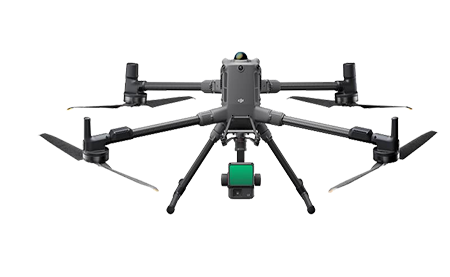
DJI MATRICE 4E

COMPACT & PORTABLE DRONE

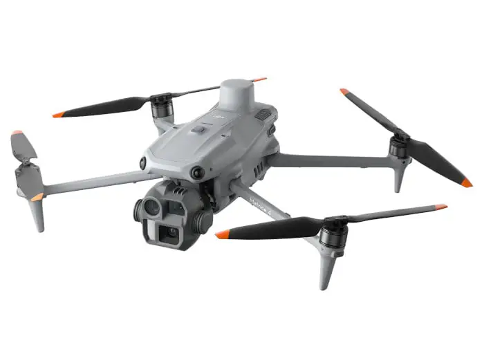
DJI Matrice 4E is a compact and intelligent multi-sensor flagship drone series for enterprise industries equipped with advanced features such as smart detection and measurement with laser range finder.

Flight operations are now safer and more reliable with significantly enhanced sensing capabilities.

DJI Matrice 4E

DJI DRONE FOR SURVEYING

Organisations choosing the Matrice 4E for their drone solutions.

ENGINEERED FOR EXCELLENCE, DESIGNED FOR VERSATILITY

The Matrice 4E is designed for geospatial applications such as surveying and mapping, construction, and mining.

DJI MATRICE 400 FEATURES

Multi-Payload Support

Multi-Payload Support

Built for Challenging Conditions

Challenging Conditions

Full-Color Vision Assist

Full-Color Vision Assist

59 minutes of flight time

59 minutes of flight time

Real-Time Terrain Follow

Terrain Follow

DJI Care Enterprise

Flexible mission planning

POWERFUL PAYLOADS

The DJI Matrice 400 has a maximum payload capacity of 6kg and can carry up to seven payloads simultaneously. It features a versatile combination of gimbal mounts (single, dual, or triple downward) and four E-Port V2 connectors, allowing for a wide range of sensors and accessories like mapping cameras, thermal sensors, spotlights, and speakers to be mounted at once. This high capacity and flexibility support various industrial applications, including mapping, inspection, and public safety.

Matrice 400’s strong payload capacity

Zenmuse P1

Zenmuse P1

Zenmuse P1 integrates a full-frame sensor with interchangeable fixed-focus lenses on a 3-axis stabilised gimbal. Designed for photogrammetry flight missions, it takes efficiency and accuracy to a whole new level.

Zenmuse L2

Zenmuse L2

Zenmuse L2 integrates frame LiDAR, a self-developed high-accuracy IMU system, and a 4/3 CMOS RGB mapping camera, providing DJI flight platforms with more precise, efficient, and reliable geospatial data acquisition.

Zenmuse H30 Series

Zenmuse H30 Series

The Zenmuse H30 Series uses a combination of five sensors—wide-angle, zoom, thermal, laser rangefinder, and NIR auxiliary light—to achieve superior day and night vision through advanced intelligent algorithms. 

Zenmuse S1

Zenmuse S1

DJI’s first spotlight for multi-payload drones, using LEP technology to provide powerful illumination for nighttime operations like public safety, emergency rescue, & inspections. It features high brightness, a long illumination distance, and multiple lighting modes.

Zenmuse V1

Zenmuse V1

The Zenmuse V1 is an innovative loudspeaker for drone payloads, featuring high volume, long-distance broadcasting, and multiple operational modes, making it suitable for public safety and emergency rescue operations.

Manifold 3

Manifold 3

A compact and powerful processing unit that provides 100 TOPS of compute power for the Matrice 400 drone. Its lightweight design, weighing around 120g, improves drone efficiency for various tasks by offering robust processing capabilities. 

ENHANCED INTELLIGENCE AND EFFICIENCY

Smart Detection

With Zenmuse H30 Series’ visible and thermal imaging, Matrice 400 can detect vehicles, vessels, and subjects during search and rescue operations or routine flights. It also supports switching to other models, enabling the expansion of application scenarios.

Additionally, it supports high-res grid photos and features powerful tracking capabilities.

Real-Time Terrain Follow

Matrice 400 supports Real-Time Terrain Follow flight in any horizontal direction [15]. This feature can be enabled during both manual flight and automated flight routes, ensuring stable relative height to the ground.

During large-scale search and rescue operations, the size of ground subjects can be kept consistent on the remote controller screen, reducing the need for frequent zoom adjustments and improving efficiency.

During mapping missions, a consistent ground sampling distance (GSD) can be maintained to obtain high-precision mapping data.

Takeoff and Landing on Ships

To address the needs of offshore operations such as maritime patrol and wind turbine inspection, Matrice 400 is equipped with the capability to take off from and land on ships, supporting takeoff from stationary vessels and landing on moving vessels.

By detecting landing point patterns on the deck, it can achieve safe and precise landings.

OPEN DEVELOPER ECOSYSTEM

Intelligent Algorithm Developer

Provides the necessary model training tools and third-party developer certification process to access onboard computing capability, helping to expand new application fields for drones.

PSDK

The newly upgraded E-Port V2 supports USB 3.0 high-speed payload communication and delivers up to 120 watts of power per port. The E4 port of the E-Port V2 can be expanded into four payload ports via the E-Port Hub expansion plate, unlocking broader application scenarios and greater potential for the Matrice 400.

MSDK

Mobile SDK 5 simplifies the development of apps to control the Matrice 400. It comes with fully open-source, production-level code samples with core modules adapted from DJI Pilot 2, guaranteeing high reliability.

Cloud API

With DJI Pilot 2’s built-in Cloud API (MQTT-based protocol), you can directly connect the Matrice 400 to third-party cloud platforms. Access the drone’s hardware, video live-stream, and photo data without having to develop an app.

Open Data Access

Developers can leverage payload, LiDAR, mmWave radar, and vision sensor data interfaces to build innovative applications and expand the DJI ecosystem.

APPLICATIONS

Geospatial Surveying & Mapping

GEOSPATIAL

Geospatial drone solutions provide highly accurate digital deliverables for managers, surveyors and engineers, improving operations throughout the project lifecycle.

Drones enable timely decision-making, cost savings, enhanced personnel safety, and optimal efficiency through aerial data collection.

  • Land Survey
    Quickly generate accurate 2D and 3D models. Cover more ground, improve safety, and reduce costs
  • Cadastral Survey
    Boost the efficiency of land administration and cadastral processes by using high-accuracy UAS solutions to quickly generate digital models

  • Urban Planning
    Create accurate 2D and 3D models that integrate seamlessly with local geographic information systems, helping teams visualise results.

LIDAR

  • Topo survey through vegetation
  • Survey during nightworks
  • Powerline survey
Lidar
Inspection of powerlines

ELECTRICITY, OIL & GAS INSPECTION

Drone inspections provide accurate data readings of critical structures or components. Through visual and thermal imagery, drones provide comprehensive information for targeted maintenance efforts and improved operational efficiency.

Electricity
Manage electrical grids and plants with drone solutions. Monitor construction, conduct inspections and maintenance with ease.

  • Powerline Inspection.
  • Substation Inspection.

Oil and Gas
Revolutionising the oil and gas industry by enhancing efficiency in management, inspection, and construction, while reducing costs and driving technological innovation.

  • Facility Inspection.
  • Pipeline Inspection.

Renewables
Flexible and mobile, capable of automatically inspecting along flight paths, effectively ensuring personnel safety and increasing power generation revenue.

  • Photovoltaic Power Plant.
  • Inspection of Wind Turbines.

Infrastructure
Optimise infrastructure inspection and maintenance work with accurate aerial inspections. Digitised records and efficiently track the condition of buildings and roofs through visual and thermal data capture and analysis.

  • Bridge Inspection.
  • Roof Inspection.

Flight Time

Estimate the Matrice 400’s flight time based on payload configuration.

Matrice 400’s flight time estimates

EASIER AUTOMATED OPERATIONS

This is DJI Zenmuse L2

The Zenmuse L2 integrates a 4/3 CMOS RGB mapping camera, a Livox LiDAR module, and a high-accuracy IMU, all on a 3-axis stabilised gimbal. It can scan complex objects within an extended range and generate accurate point clouds faster. With a detection range of up to 250 meters and a reduced laser spot size, it can detect smaller and more detailed objects, even in dense vegetation, resulting in more accurate digital elevation models.

The Zenmuse L2 can capture LiDAR and photogrammetry data simultaneously while maintaining True Color LiDAR data. It’s the perfect tool for professionals in various industries, including surveying and mapping, energy, forestry, and construction.

FREQUENTLY ASKED QUESTIONS

The Matrice 400 can fly for up to 59 minutes. 

It can carry a maximum payload of 6 kg. 

It can support up to seven payloads simultaneously, depending on the configuration. 

It has a maximum wind speed resistance of 12 m/s.

Yes, it is designed to operate in temperatures from -20C to 50C.

It uses a combination of omnidirectional binocular vision, upward-facing LiDAR, downward 3D infrared sensors, horizontal rotating LiDAR, and mmWave radar for six-directional detection. 

The O4 Enterprise system can transmit video up to 40 km under ideal conditions.

It can act as a relay drone to extend operational range, and it supports the use of two cellular dongles to maintain a stable signal. 

The ingress protection rating is IP55 rated. Do not fly in rain heavier than 100 mm/24 hr.

The IP rating is not permanently effective and may decrease due to product wear and tear.

PAIR YOUR DRONE WITH POWERFUL SOFTWARE

Maximise the potential of your DJI drone with our industry-leading photogrammetry and mapping software solutions. Process your data with confidence and generate accurate deliverables.

ADDITIONAL DRONE MODELS

DJI MATRICE 350 WITH P1 CAMERA OR L2 LIDAR
FLAGSHIP SURVEY DRONE

Integrate Lidar and office processing.  Topo mapping through vegetation, powerlines, applications beyond photogrammetry.

DJI DOCK 2
DRONE IN A BOX
 

Drone in a box
DRONE HARDWARE & SOFTWARE

Complete Drone in a box solution including hardware and software for multiple applications. A drone solution at your fingertips.