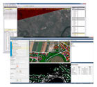
New Trimble Remote Sensing Suite
 The Trimble Remote Sensing Suite combines the capabilities of the new Inpho® SATMaster module with the industry leading eCognition® software to address the needs of professionals generating high quality data, models and analytics from satellite based imagery.
SATMaster provides streamlined workflows to generate surface DTM’s/DSM’s and from overlapping satellite imagery. The models can be used to quickly generate terrain corrected orthomosaics over large areas for base mapping data or for further information extraction within eCognition Essentials. eCognition Essentials, included with SATMaster, provides remote sensing and GIS professionals with a guided workflow to easily generate land cover maps for applications such as environmental mapping, vegetation monitoring and other landscape changes. New change detection capabilities enable quick comparisons between different time based imagery sets or between imagery and GIS layers. Monitoring deforestation, urban expansion, or agricultural change can be performed quickly and accurately with the SATMaster solution.
For more advanced applications, such as monitoring planning permits and vegetation clearances, professionals can utilise the full Remote Sensing Suite comprising SATMaster and eCognition Developer and Server. The enhanced offering provides more sophisticated and customizable analysis of satellite imagery allowing professionals to update GIS layers create specific analytical applications.

