SiteVision for Cadastral Surveyors
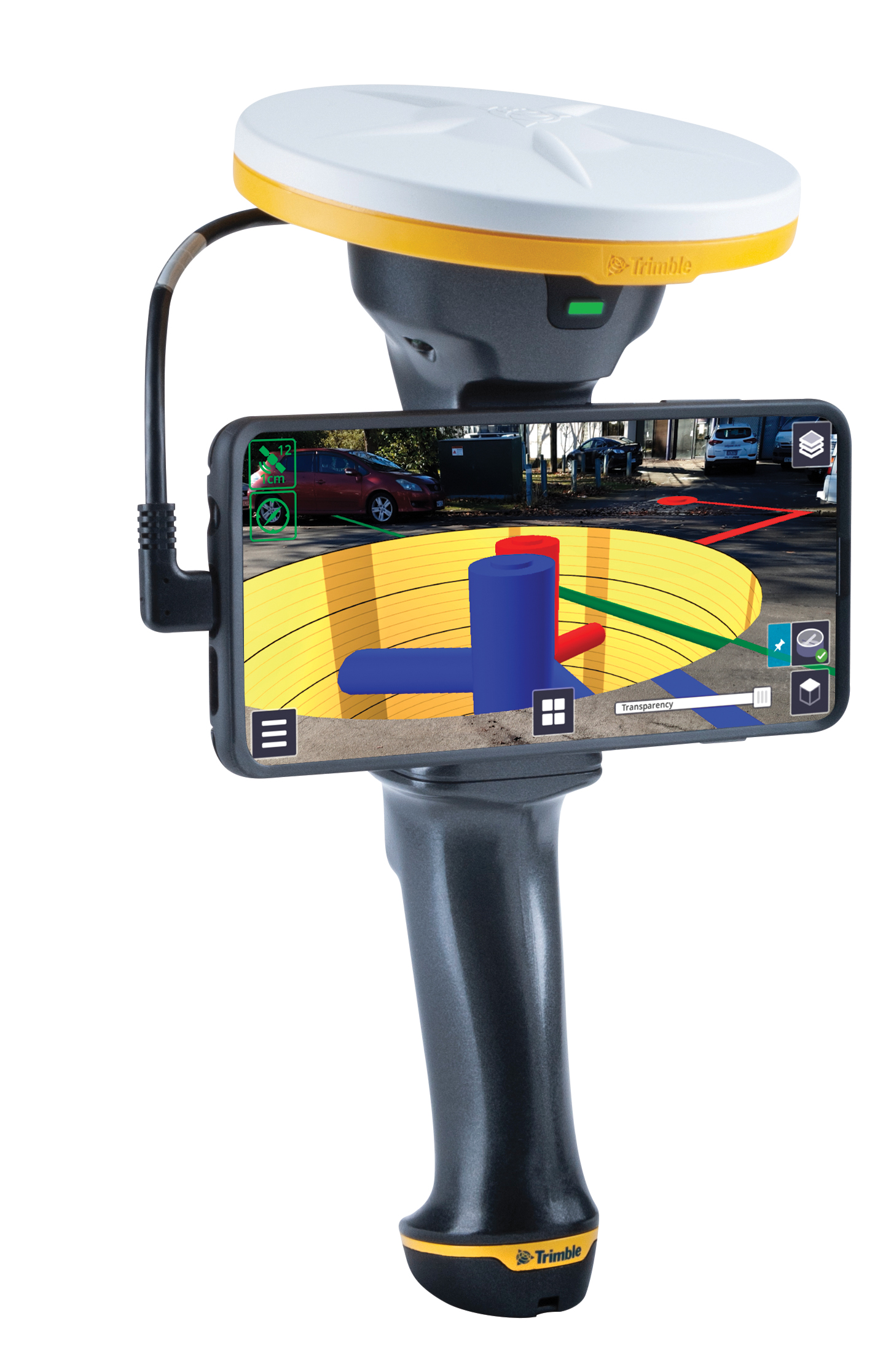
SiteVision is a great tool for visualising data but what value does it provide to me as a Cadastral Surveyor?
Great question.
SiteVision has three main uses for Cadastral Surveyors:
- Finding survey monuments for the origin of your survey (Point of Beginning)
- Communicating property line information, including natural boundaries, to your clients
- Checking occupation against property lines to check for encroachment
Let’s look at this in more detail.
![]()